 Skip to main contentSkip to footer
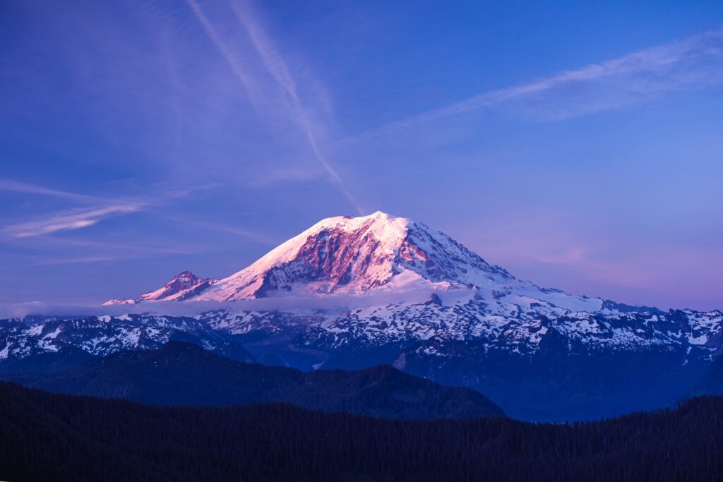
Any time you’re feeling like a great hike is just what the doctor ordered, Mt. Rainier has got your back with many trails to choose from! From short and easy day hikes for beginners to challenging ascents that will take more than one trekking session, all levels of hikers are covered when it comes to these breathtaking landscapes!
The five best trails for all levels to explore at Mt.Rainier include:
- The Grove of the Patriarchs Trail, Stevens Canyon
- Myrtle Falls Trail, Paradise
- Naches Peak Loop, Pacific Crest Trail
- Tolmie Peak Trail, Carbonado
- Camp Muir Route via Skyline trail
This is your chance for an adventure! If you’re looking for a place to stay, check out our vacation rental guide for Mt. Rainier.
Strap on those hiking boots because this article’s gonna take a walk with you through some of Mt. Rainier’s most scenic hikes. We’ll will discuss exactly what you can expect from these trails, how long it takes to hike them, the best time to visit, as well as things to look out for while hiking these trails.
Table of Contents
1. The Grove of the Patriarchs Trail
The Grove of The Patriarchs hiking trail is home to some of the oldest, most regal trees. Over a thousand years old, the Douglas firs, red cedars, and hemlocks are ancient behemoths that are revered and protected.
The trail itself is situated on the east side of Mt. Rainier at the mouth of the Stevens Canyon’s Entrance and across from the Ohanapecosh River.
What to Expect
In this protected area, you’ll find what remains of the Cascadia conifer forests. But what you’ll particularly enjoy is the small suspension bridge, which is a narrow stretch of the walkway over clear blue waters of the Ohanapecosh River.
Level of Difficulty
This trail is for the first-timers, an easy hike that caters to people of all ages and levels to enjoy and take in the beautiful trees. However, if you are not a beginner, but are in the mood for an easy hike, this will give you an enjoyable tour.
Distance and Time
You and your family—even the little ones—can hike this 1.2-mile (1.93-km) trail in under an hour. But you might want to take more time for a picnic, or just to breathe in that fresh mountain air.
Best Time To Visit
The trail is well maintained, and you can expect to see some considerable traffic from tourists, hikers, and joggers. The best time to visit would be from June through October, but if you enjoy winter hiking, you can go at any time.
2. Myrtle Falls Trail, Paradise
Paradise is just the word I’d use to describe Myrtle Falls. With a clean and unfettered view of the snowy peaks of Mt.Rainier right behind it, you’ll find Myrtle falls about a half-mile up the trail.
The trail also runs towards—and later blends with—the Skyline Trail, from where you can get an even better view of Mount Rainier and Edith George.
What to Expect
It’s the Myrtle Falls Viewpoint that you need to look out for during your hike. If you follow the signs and take a short detour at the spur trail, it will take you to the infamous viewpoint. This is the perfect spot from where you can enjoy the 72-foot (21.95-meter) Myrtle Falls, as well as the snow-capped peaks of Mt.Rainier beyond it.
Level of Difficulty
This is one of the most accessible trails to hike in Mt.Rainier with family and friends, perfect for people of all ages—even kids in strollers! You might also want to bring anyone who usually has trouble with mobility, so they can enjoy the view as well.
Distance and Time
This trail rounds off at just 0.8 miles (1.29 km) with a total ascent of 100 feet (30.48 km). The trailhead begins right at the Parking Lot at Upper Paradise and will only take you 30-45 minutes to make this hike.
Best Time to Visit
This is an often-hiked trail, and the best time to visit it, and Mt.Rainier, would be from June to mid-October.
3. Naches Peak Loop
The hike along this trail is like taking a brisk walk over vast stretches of lofty alpine meadows scattered with wildflowers. If you’re lucky, you’ll even find some huckleberries. You’ll be hiking along the Pacific Crest Trail, which means you’ll be making a clockwise loop around the northern flank of the Naches Peak.
What to Expect
While the entire trail promises several beautiful views, and the wildflowers are definitely a must-see, make sure to stop by at the Dewey Lake viewpoint. From there, you can see Dewey Lake that lies about 600 feet (182.88 meters) below.
Don’t forget to stop by Tipsoo Lake at the end of your hike for a picnic lunch.
Level of Difficulty
While not as tricky as some of the other hikes on this list, the Naches Peak Loop is probably best suited for intermediate hikers who’ve worked their way through a few trails. But if you’re a beginner and want a bigger challenge, this trail will not disappoint you.
Distance and Time
This hike takes around 2 to 2.5 hours to complete, and the trail runs for 3.6 miles (5.79 km) along the Naches Peak, with an ascent of 680 feet (207.26 meters). If you want to slow down and enjoy the sites, however, it will take you longer.
Best Time To Visit
The best time to visit is in late July or early August when all the wildflowers are in full bloom. You’ll be treated to a bed of blue from lupines, white from bistorts, and magenta flowers, offset by green grassy slopes.
4. Tolmie Peak Trail
Tolmie Peak is all about dramatic views, amazing hikes through woodland areas, blue marble lakes, and an old fire lookout to round it all off.
However, this hike offers more than just grand views at every turn, as it provides some much-needed quiet space to enjoy the winding trail as it culminates at the Tolmie Peak viewpoint.
Getting to the trailhead is the easy part, as you’ll find it on the left side, right off the road, at the foot of Mowich Lake, which is by itself a must-visit spot.
What to Expect
If you manage to make it to the cradle-like basin where you’ll see Eunice Lake, you’re in for a treat. The sparkly lake is where you’ll find one of the four fire lookout stations in the Mt.Rainier National Park. From there, the view is like a slap-on-the-face and a kick-in-the-gut, all at once, as it really does take your breath away.
Level of Difficulty
Tolmie Peak Trail has been categorized mid-to-high intensity on the difficulty level. While you do get foot traffic here, it’s mostly from skilled and avid hikers who’ve got what it takes to make it to the top of the trail—and then make their way down—in one piece.
Distance and Time
With over 5.7 to 6 miles (9.17 to 9.66 km) to cover, this hike will take you anywhere between 5-7 hours, seeing as how there’s quite a plunge and subsequent climb once you get to Ipsut Pass. Most people call it a day after they hit the halfway mark at Eunice Lake, around 3.2 miles (5.15 km) into the hike.
5. Camp Muir Hike
The hike up to Camp Muir takes the better part of the day, which is why you’ll have to set camp overnight before you make the journey back down. You’ll find that this trail runs along Skyline Trail and up to Pebble Creek before you face a steep ascent up Mount Rainier.
Camp Muir is as close as you can get to the summit without a permit, so it takes quite a bit of skill and experience to make your way up there. You’ll also have to carry adequate supplies and provisions.
What to Expect
Did you know that Camp Muir is also known as the Cloud Camp? You can guess why! Keep an eye out for the snowy peaks, icy glaciers, and gaping crevasses, and you’ll not be disappointed.
When you’ve ascended to around 8,500 feet (2,590 m/ 2.59 km), you’ll find that the terrain evens out just a little. This is where you’ll be able to look over at the towering walls of Gibraltar Rock and even catch a glimpse of ‘Little Tahoma.’
Level of Difficulty
Only a skilled expert with experience and perseverance can hike up this trail. Remember that you’ll also be carrying supplies that will weigh you down, all the more reason why only an expert should attempt this strenuous hike.
Only one other hiking trail is more strenuous than this one—and that’s more of a 10-12 day trip than a hike—is The Wonderland Trail, which is just over a whopping 93 miles (149.67 km).
Distance and Time
The hike up the trail to Camp Muir takes 10-12 hours, and the 9-mile (14.48 km) stretch can prove steep and tricky to navigate. You’ll need to be in top condition before you attempt this hike.


